Studying the Impact of LAMC 41.18
As the unhoused population continues to climb in Los Angeles, laws are implemented to restrict their permanence and visibility across the city. Ordinance 41.18 exemplifies this short-term effort to hide homelessness by prohibiting people from obstructing public rights of ways and introducing a ban to sensitive-use areas such as public schools, libraries, parks, and daycare centers. Illustrative mapping data and a comprehensive literature review examine the ordinance’s impact on the densities of the unsheltered unhoused populations across different census tracts in Los Angeles City.
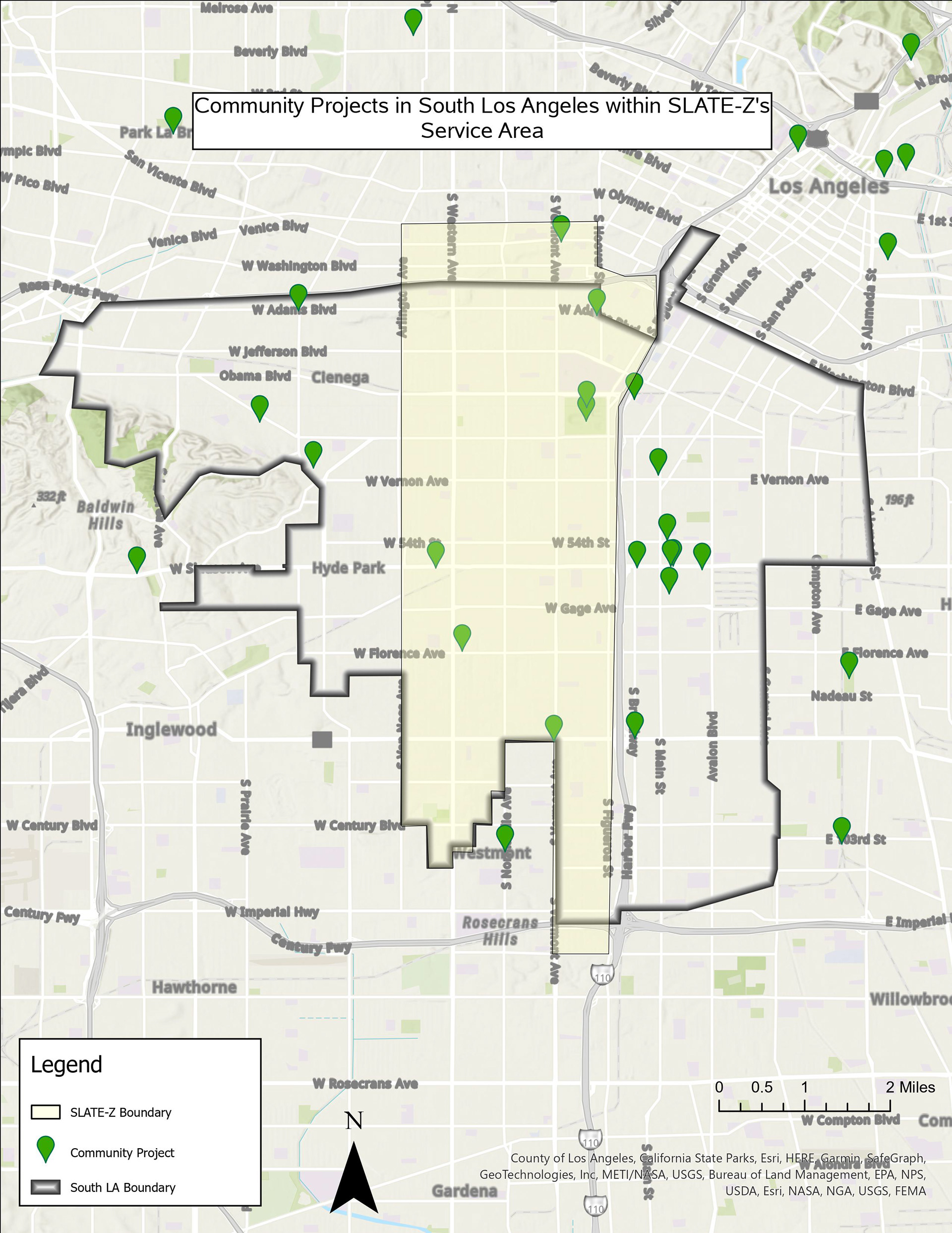
SLATE-Z South LA Project Mapping
Working closely with the South Los Angeles Transit Empowerment Zone (SLATE-Z) and the UCLA Sustainable LA Grand Challenge, our project endeavors to locate community projects in South Los Angeles and provide SLATE-Z with vital information regarding sustainable infrastructure development. Employing ArcGIS, we mapped 15 sustainability projects within the SLATE-Z and South LA boundary accompanied by a suitability analysis map that visualizes optimal locations for new projects.